At the margin of the city
Sant’Elia can be seen as a typical example of a marginalized space as per spatial, social and symbolic criteria (Cattedra, Memoli, 2013). It has approximately 9,000 inhabitants with an average age lower than in other districts (the average age is 41, whereas Cagliari’s average is 48 years old). Besides, the unemployment rate in this district is definitely higher than in other areas (respectively 43% and 31%), especially for women (respectively 53% and 47%).
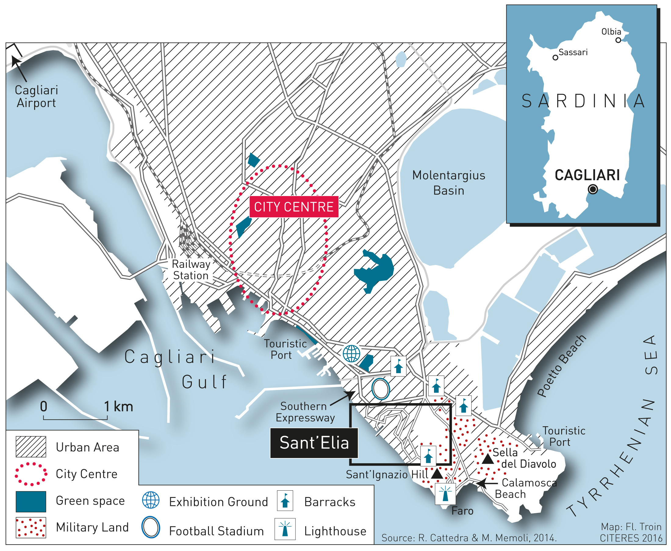
From a spatial point of view, Sant’Elia is approximately 2 km away from the city centre. It is surrounded by military and civilian infrastructures, including military land, barracks, the city football stadium, and an expressway. These infrastructures contribute to mark its “distance” from the other districts and contribute to its isolation. Sant’Elia is traditionally plagued by a chronic lack of educational, health, commercial and recreational services.
A marginal space for a marginal society
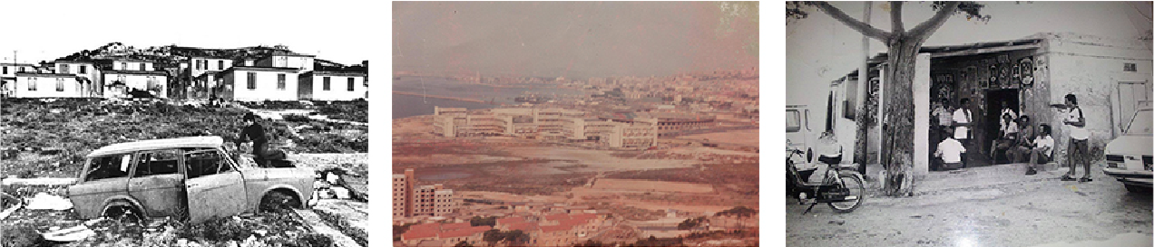
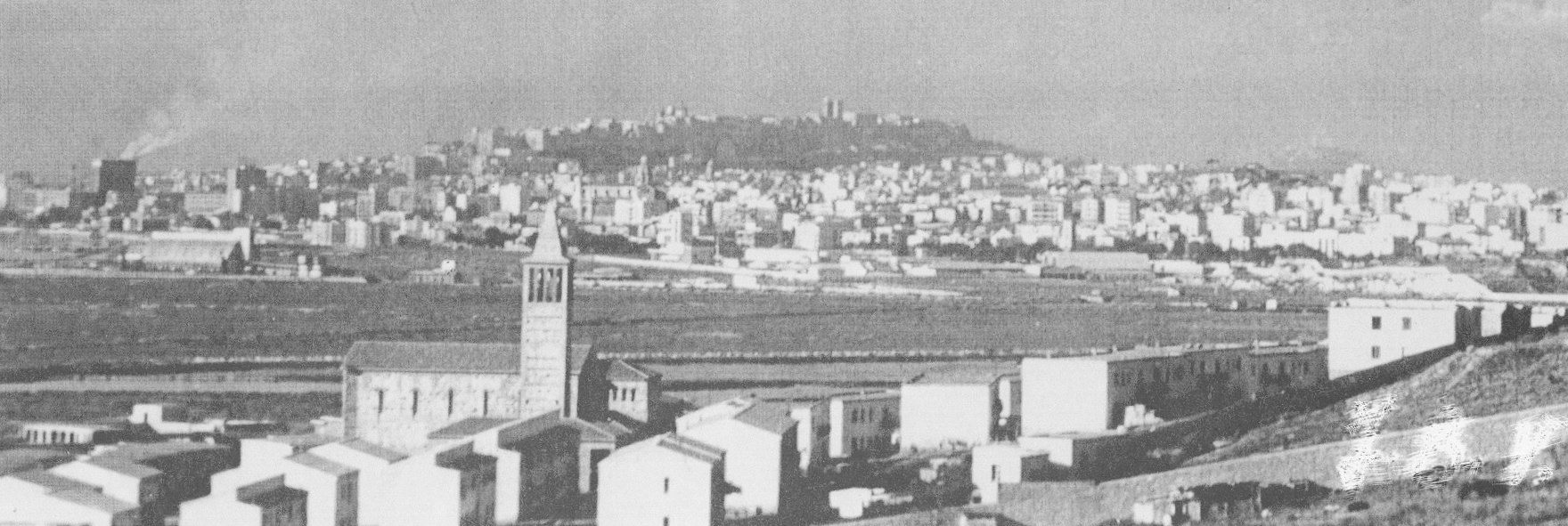
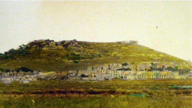
The district is divided into two well defined areas that feature different architectural styles. The buildings in each area were built during different time periods, as their names also indicate: one is Borgo Vecchio (Old Hamlet) and Borgo Nuovo (New Hamlet). The old part of the district mainly features two or three storey buildings arranged in a terraced housing style at the foot of the Sant’Elian hill. It was founded between 1951 and 1956, in order to find a solution for the precarious condition of thousands of families within the city that had become homeless after World War II.
Approximately 500 families found accommodation in Sant’Elia and the leper colony included in its area, which is called Lazzaretto. Many residents in Sant’Elia were born in the premises of the lapper colony and the building has therefore acquired a symbolic status through which residents affirm their identity and belonging to this district. Today Lazzaretto has been restyled to serve as a cultural venue for art installations and exhibitions for all the citizens in Cagliari.
The blocks
The blocks in the newer part of the district were built between the 1970s and 1990s. They were made of reinforced concrete and followed the building rationale of that time, i.e. low cost and low quality mega-structures aiming to provide as much accommodation as possible. It was designed to accommodate approximately 1,200 families that had been relocated from different areas (e.g. some were from the Borgo Vecchio, others from other districts and cities within the region).
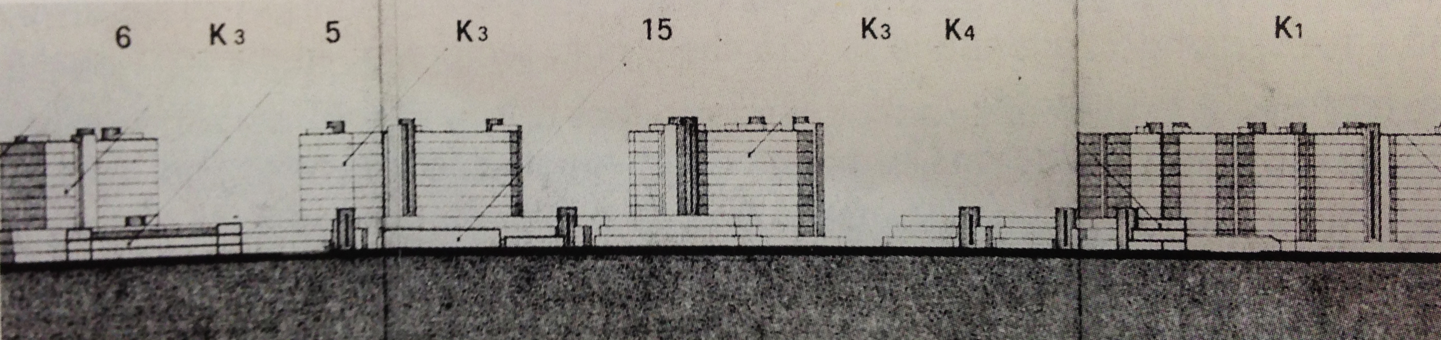
A first draft of Saint Elia's profile in the 1973, designed by engineers L. Deploy and G. Sgualdini. It’s clear the relationship with modernist architecture of Le Corbusier and the Chart of Athens. Source: urbancenter.eu.
Unfortunately, this also resulted in an increasing feeling of ghettoization that still characterizes Sant’Elia as a place for people with low-income and social status. Due to its history, Sant’Elia has an extremely negative reputation, which is further reinforced by the local media, the inhabitants of other districts in Cagliari and, partly by the residents of Sant’Elia themselves. It is seen as a “dangerous” place, ruled by local criminals and drug traffickers (Piras, 2001); it is a typical example of the so-called blemish of place (Wacquant, 2007). This has significant consequences on the dwellers’ everyday life. For instance, they struggle to find a job outside Sant’Elia.
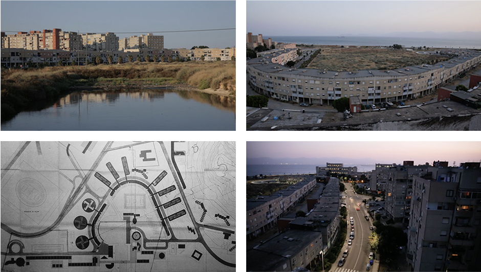
Planimetry P.E.E.P. Plans for the Economic and Popular Building of Sant'Elia - Istituto Autonomo Case Popolari.
Source: urbancenter.eu.
Representation
In Cagliari, Sant’Elia borders the Mediterranean Sea to the south and to the west and the Sant’Ignazio hill to the east; it is also surrounded by military infrastructures, including military land and barracks. Massive public infrastructures to the north-west and an expressway to the north contribute to isolating this district from the other areas and the rest of the city. Moreover, there are only two streets leading into Sant’Elia that further mark its physical distance from other districts. These factors clearly contribute to enhancing the feeling of isolation and marginalization among the residents. Apart from being geographically and socially marginalized from the rest of the city, Sant’Elia also offers a varied landscape that includes the romantic beauty of Borgo Vecchio, the rectangular and repetitive shapes of modern and often run-down blocks of flats, the bright sea in front of it and the peaceful mountain at the back.
Our purpose
Sant’Elia features a lively everyday life, which can be described as integrated and developed around the concept of community. It attempts to tackle and dilute the difficulties of an economic and social context that is marked by high levels of unemployment, illegal crime, low levels of education, etc. By and large, Sant’Elia is a symbol, a place of contrast and conflicts, and it can be said to epitomize the striking beauty of an urban landscape and the issues relating to social housing. It is a symbol of the opposition between the sharp and cold appearance of its enormous blocks of flats made of reinforced concrete and the warm and friendly atmosphere of Borgo Vecchio. Sant’Elia is a place where the sharp difference between everyday city life and social policy and urban planning become evident. Our choice of carrying out a project that allowed the residents to express their subjective point of view regarding life in a “marginalized district” coincided with our decision to adopt a set of different instruments during the various steps of our experiment.
* This text resumes the considerations of the following publications: 1) Aru S., Memoli M., Puttilli M., (2017), “The margins “in-between”. A case of multimodal ethnography”, City. vol. 21, issues 3, (publication ongoing). 2) Memoli M., Cattedra R. (2014), “Un contre-lieu d'urbanité marginale. L'exemple du quartier de Sant'Elia (Cagliari)", in Semmoud N., et alii, Marges urbaines et néolibéralisme en Méditerranée, Tours, PUFR, pp. 125-144.